- info@easternstevedores.com
- BJ14, BJB Nagar, Bhubaneswar, ODISHA, INDIA.
Port Details

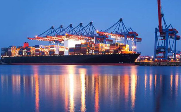
Paradip Port Details
In 1950 the Central Water & Power Commission proposed a Port between the Kolkata and Vishakapatnam, then Chief Minister of Odisha Biju Patnaik suggested construction of port in Paradip on Mahanadi river. The Paradip Port was the brainchild of Biju Patnaik.
The foundation stone for Paradip port was laid on 3 January 1962 by Pt. Jawaharlal Nehru, the Prime Minister of India. The inscription on the black granite stone records a simple message in Oriya, English and Hindi: “Willed by the people, I commend you, to this another National Adventure”. The State Government of Orissa started construction work on 15 March 1964, with the Central Government taking over management on 1 June 1965. The construction of Iron Ore Berth was completed and INS “INVESTIGATOR‟ had the privilege of maiden berthing in the port on 12 March 1966.
The port was declared open by Mr. Peter Stambolić. The Port commenced operations with the export of a few thousand tons of iron ore, and has subsequently grown to the point of handling more than 50 million tonnes of cargo during the 1st decade of the 21st century.
Paradip has been identified for development as one of the six major petroleum, chemicals and petrochemical investment regions (PCPIRs) in India, along the lines of Pudong in China, Rotterdam in Europe and Houston in North America. The Paradip PCPIR has identified an investment potential of US $68.84 billion, spread over 284 square kilometres (110 sq mi) in the area.
Govt of Odisha planned to pump in Rs 300000 Crore into Paradip by 2025. So existing infrastructure planned upgradation. Newly planned railway line Paradip-Haridaspur is in verge of completion. A new greenfield corridor highway has been planned between Bhubaneswar & Paradip. Coastal Highway planned connecting Dhamara Port & Astaranga Port with Paradip. A new Airstrip has been proposed by GoO to facilitate transportation down time.
Plan to make the biggest PCIPR Region in Asia. Paradip city along with neighboring semi-urban area has been master planned to be developed as industrial city by 2030 by Paradip Development Authority.
Port Charges:
The Cargo related charges, payable by Exporters/Importers are levied on the basis of tonnage (MT) of the cargo. The vessel related charges such as berth hire, Pilotage, port dues etc. payable by shipowners, are levied on the basis of GRT of the vessels. Port SCALE OF RATES containing details of Port charges can be obtained on payment from the Traffic Manager, or the Public Relations Officer of the Port Trust.
Local Holidays:
Charter- party holidays as laid down by the Cuttack Chamber of Commerce every year.
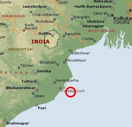
Location:
Latitude 20’ – 15’ – 55.44″ NLongitude 86’ – 40’ – 34.62″ E
(210 nautical miles south of Calcutta and 260 nautical miles north of Visakhapatnam.)
Meteorological Data:
Maximum Temperature 41.4’ C.Minimum Temperature 8.9’ C
Annual Rainfall:
Average Wave Height 1.5 mtrs. to 2.5 mtrs. (summer)Average Wave Height 0.9 mtrs to 1.2 mtrs. (winter)
Maximum Wave Height 5.30 mtrs.
Minimum Tide 0.40 mtrs.
Maximum Tide 3.50 mtrs.
Wave direction:
April-September: S.W.October-March: N.E./E.
Average Wind Speed:
Summer: 35 to 42 Km/Hr.Winter: 18 to 24 Km/Hr

